GET A FREE QUOTE TODAY - CALL US UK 07765252915 kevin.saunders@dmands.co.ukwww.dmands.co.uk
SERVICES
01
Aerial Mapping, Images and Video
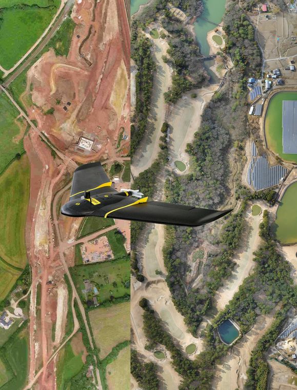
Digital Mapping and Survey uses RTK drones to enhance its surveying capabilities. We have fixed wing and rotary drones. We also have RTK and standard positioning capabilities. Using our advanced RTK drone we can get sub 3cm RMS accuracy with little or no ground control.We have personnel with over 20 years experience in mapping, Aero triangulation, Orthophoto and 3Dmodeling.
02
Ground Surveys
Digital Mapping and Survey use highly accurate Trimble ground survey equipment. We have completed topographic surveys all over the world. Surveys have been completed in Japan, the Middle East, Africa, Europe and the UK. The survey equipment is also used to ground control and aerial surveys.
03
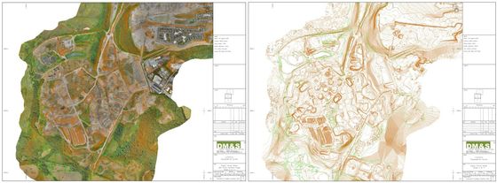
Geospatial solutions
Digital Mapping and Survey has personnel with over 30 years experience in mapping , surveying, geospatial services and remote sensing.
Experience include revision mapping of entire European countries, large exploration and resource surveys, road surveys, rail surveys, golf surveys, volume surveys, vegetation health classification surveys and monitoring. Boundary disputes, surveys for planning, and Engineering surveys
04
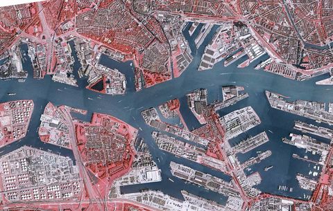
Aerial Imagery and video
Digital Mapping and Survey has several aerial platforms. These are used for collecting vertical imagery for mapping as well as oblique images and video. The obliques and videos can be used for visualizations, inspections and diagrams
CONTACT
CONTACT
MOB: UK 07765252915
kevin.saunders@dmands.co.uk
MOB: UK 07765252915
kevin.saunders@dmands.co.uk